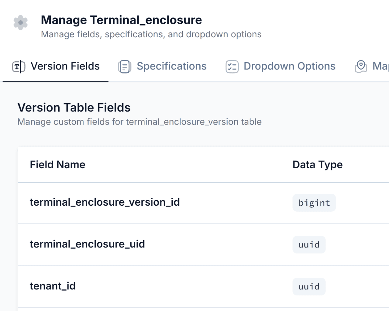
Specification-driven objects
Define fields, records, and display behavior for every asset from one structured workspace.
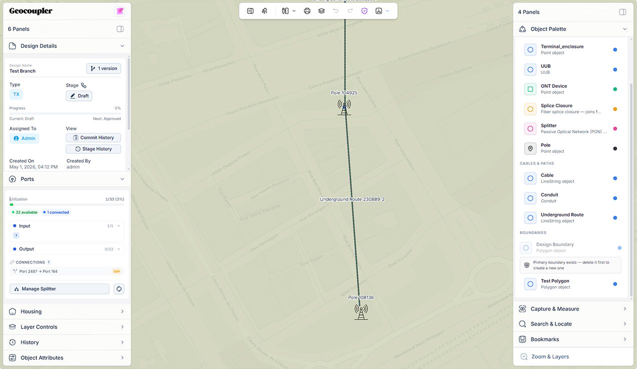
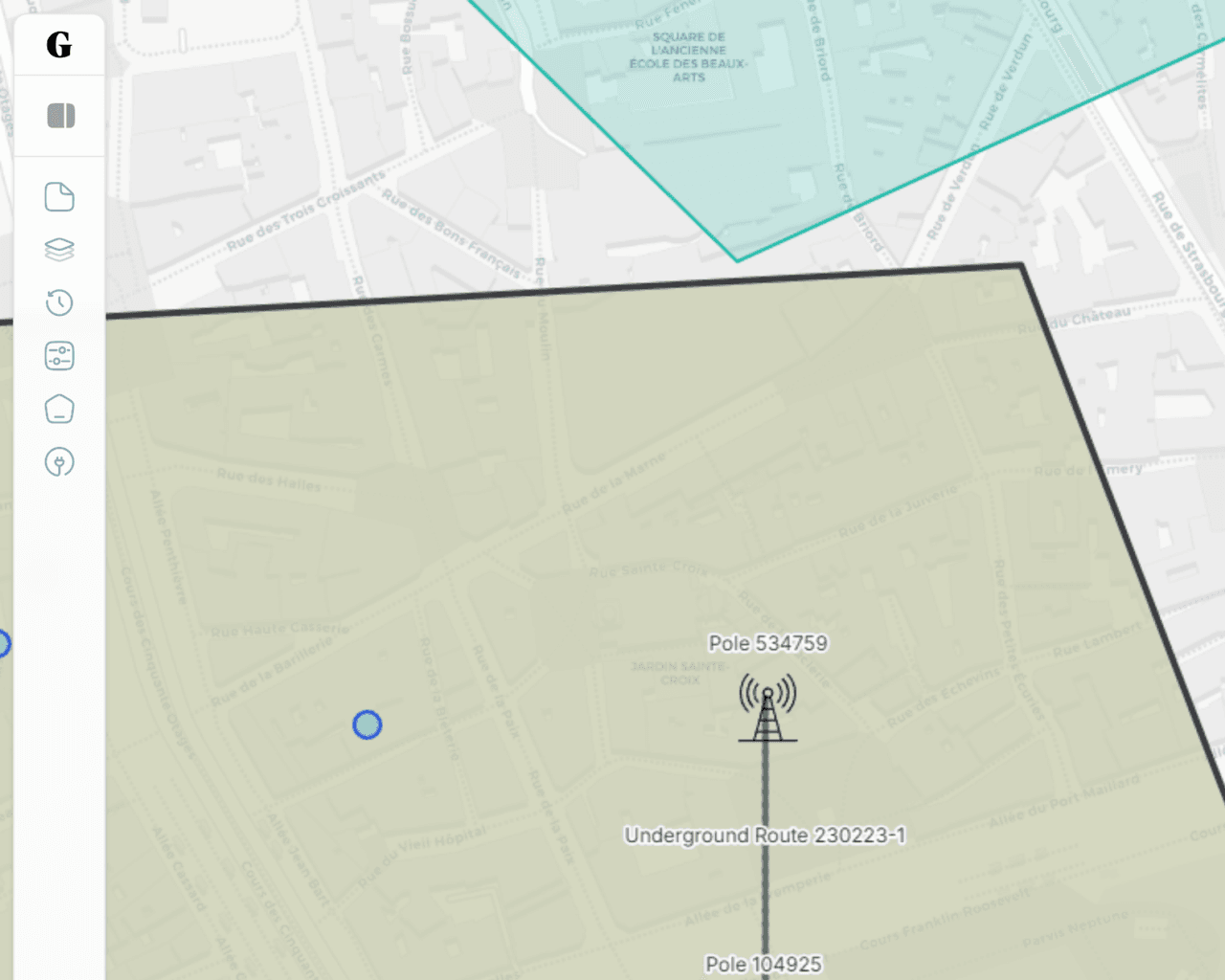
Operations workspace
A flexible planning workspace for structured data, rule logic, and multi-team execution.
Define fields, records, and display behavior for every asset from one structured workspace.
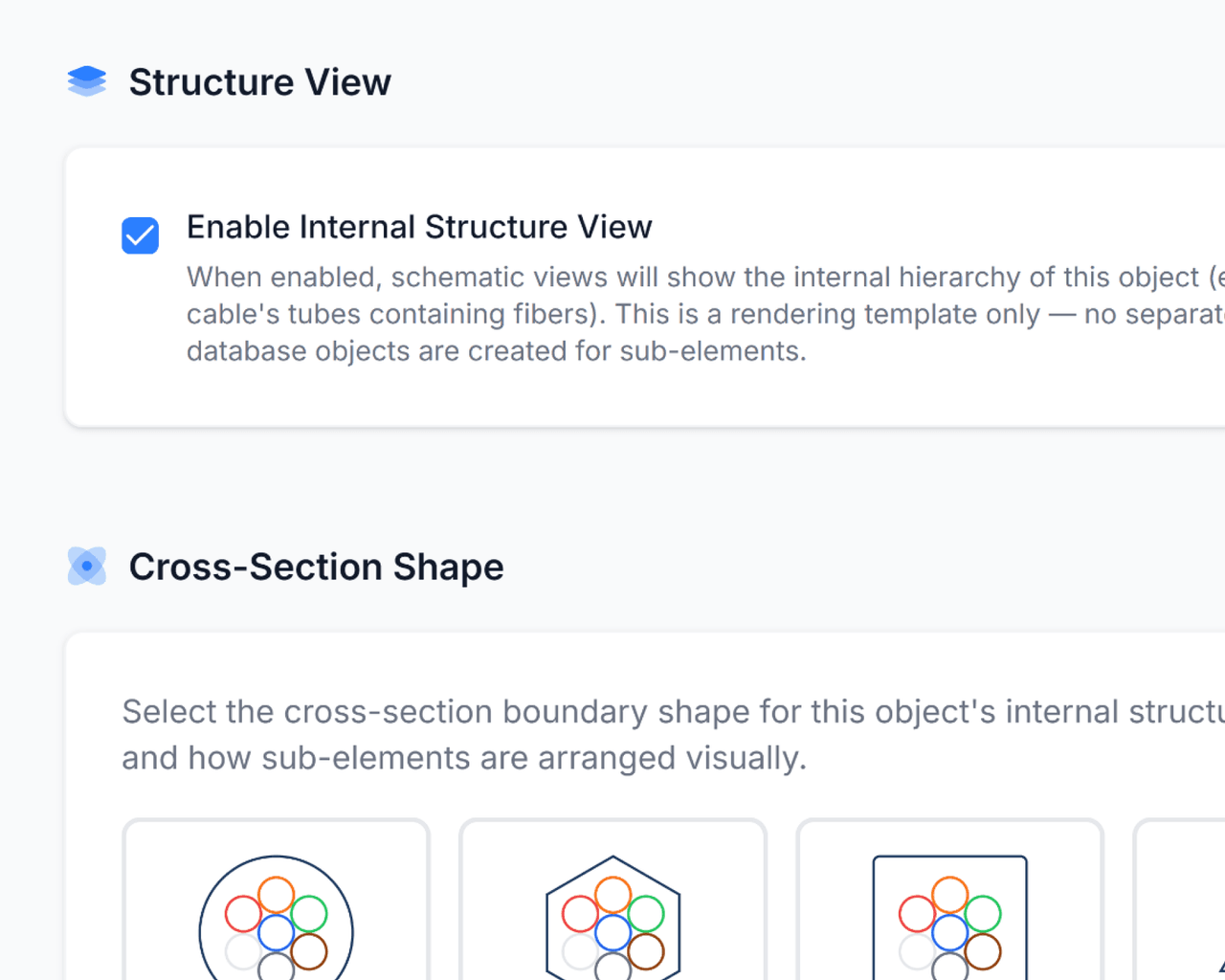
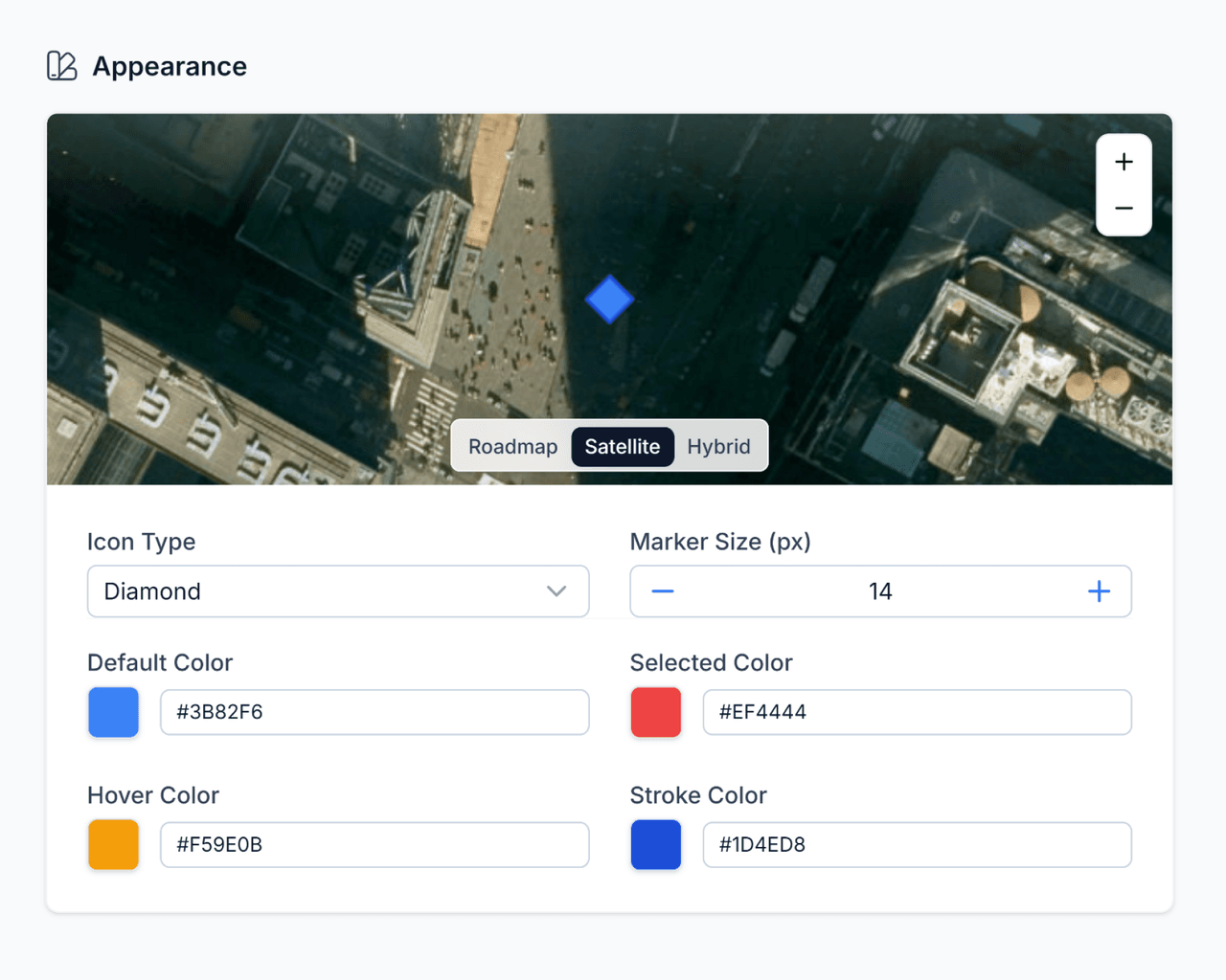
Configure cross-sections, color schemes, and hierarchy views for complex network components.
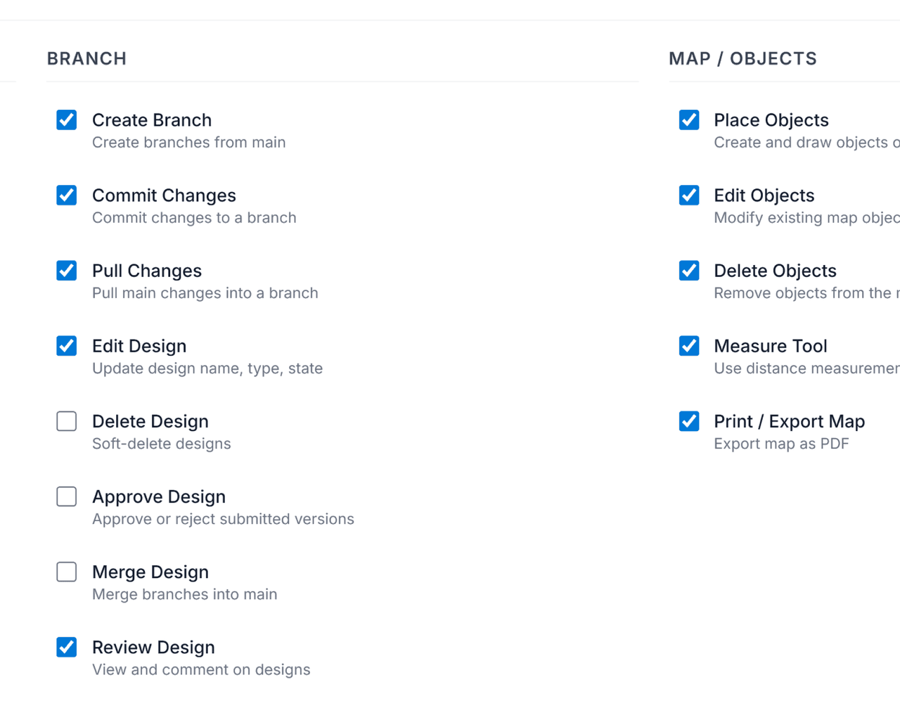
Keep layers, approvals, and object attributes in a focused control surface built for daily operations.
Keep layers, approvals, and object attributes in a focused control surface built for daily operations.
Turn planning constraints into reusable visual rules that teams can review and enforce together.
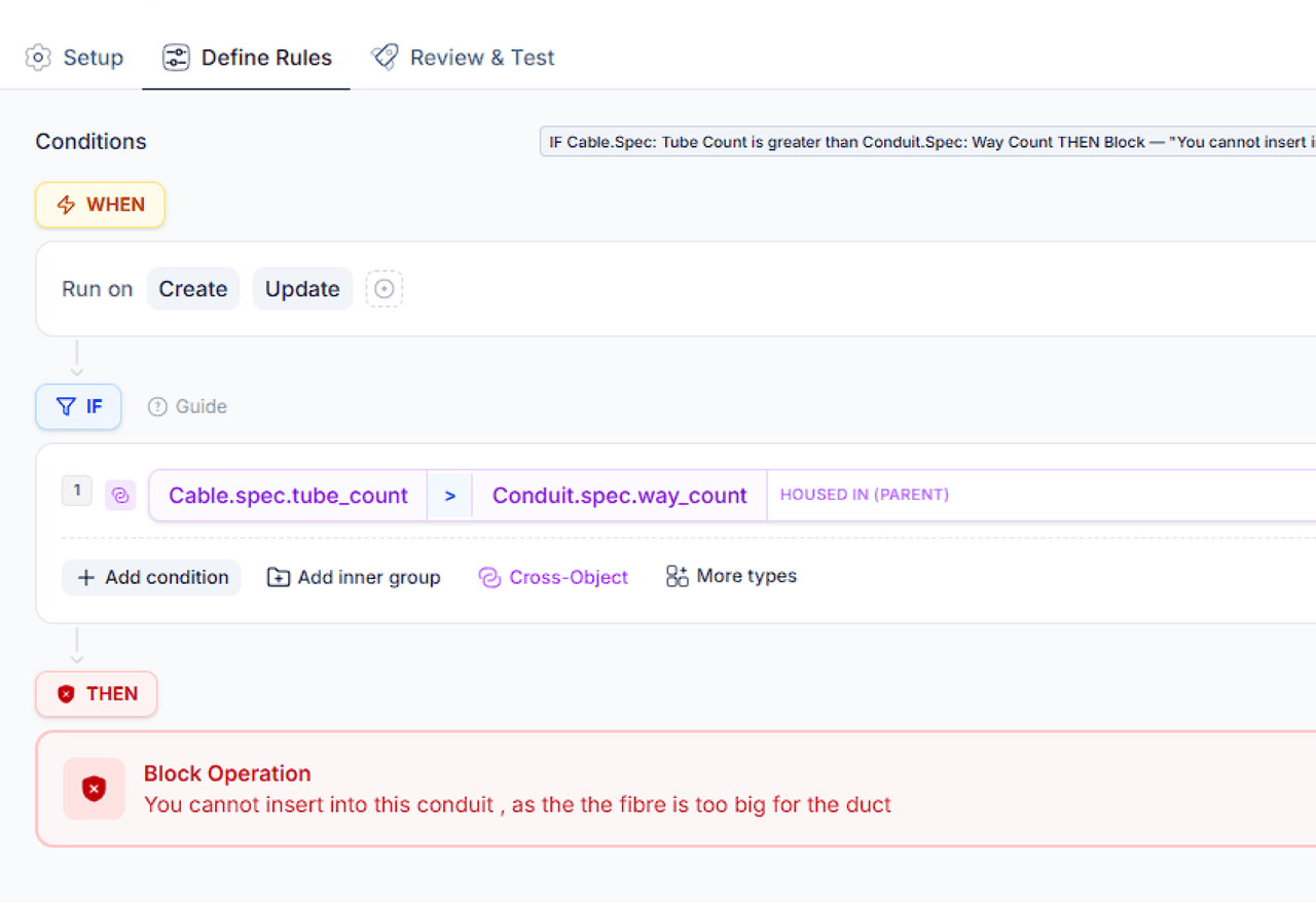
Turn planning constraints into reusable visual rules that teams can review and enforce together.
Keep layers, approvals, and object attributes in a focused control surface built for daily operations.
Meet

AI Native GIS Assistant - built for Geocoupler. MCP , AI agent, and custom panel support coming in Q3
Making AI-native network planning effortless for teams using the leading agent platforms
Integrate Geocoupler's infrastructure into existing workflows to automate planning operations at scale.
BUILT FOR BUILDING
AI Ready API Docs, Use MCPs to connect your agent platform.
Manage workspaces, objects, versions, and publishing flows through a single geospatial API.
Integrate Geocoupler from TypeScript, Python, or internal orchestration layers.
import { Geocoupler } from '@geocoupler/sdk';
constgc = newGeocoupler({
token: process.env.GC_API_KEY,
});
const { branch } = await gc.branches.create({
workspaceId: 'melbourne-cbd',
name: 'capacity-upgrade',
});
Use AI to manage everything from design generation to change management.
Scroll into this workflow section to preview a one-pass draft network review.
Upload a network spec PDF and Georgia will generate a draft network for review.
Flexible by design
Configure and use it for your business requirements. Use Georgia or let us help you set it up.
Telecom
Energy
Utilities
Water
Transportation
Government
Community
Renewable Energy
Greenfield Projects
Security
All traffic is encrypted via TLS, user credentials are stored with encryption at rest, all data is stored in the U.S., and we monitor DDoS activity and uptime 24/7.
Your data stays yours.. Every map has clear permission controls. Choose who sees maps and when. Enforce SSO as another layer of access management.
SOC 2 is the gold standard for security practices. Geocoupler has obtained SOC 2 Type 2 compliance and is under observation for type 2.
Connect your data sources and instantly understand your network planning potential. 2x faster planning, 10x more iterations, and a whole lot less headaches.
